
The Development of South Florida From Early Settlements to Modern Luxury Homes
South Florida’s development is visible in the contrast between its neighborhoods. Mediterranean courtyards recall the ambitions of early resort builders. Waterfront homes overlook canals that transformed the coastal landscape. Former agricultural communities have become established cities, while inland estates reflect a different vision of space, privacy and residential life.
These places did not emerge from a single development boom. They evolved through generations of settlement, infrastructure investment, architectural experimentation, migration and rebuilding.
Understanding that history requires looking beyond the skyline. It means considering the people who lived here before modern cities, the railroads that connected coastal settlements, the farms that sustained early communities and the water management systems that supported expansion. It also means recognizing the environmental changes and social inequalities that accompanied growth.
This account concentrates on southeastern Florida, particularly Miami-Dade, Broward and Palm Beach counties. Within that broader history, Pompano Beach, Lighthouse Point, Deerfield Beach, Boca Raton and Parkland provide distinct examples of how the region developed and why its residential landscape remains so varied.
The Landscape Before Modern Cities
Before subdivisions, highways and resort hotels, South Florida was a mosaic of coastal ridges, pine forests, hardwood hammocks, wetlands, rivers and mangrove shorelines.
Water shaped the geography. Small differences in elevation influenced where particular plants grew, how water moved and which areas could support settlement. The relatively higher Atlantic Coastal Ridge became an important location for the modern metropolitan area, while the lower interior supported the wetlands of the Everglades.
The region’s underlying limestone and its water system are closely connected. South Florida’s landscape cannot be understood simply as dry land beside an ocean. Its geology, groundwater, seasonal rainfall and coastal waters form an interconnected system. Modern development altered that system, but did not eliminate the conditions that shaped it.
Nor was the region an empty wilderness awaiting discovery. Indigenous societies lived throughout South Florida long before European contact. The Tequesta occupied southeastern areas, while the Calusa were associated with the southwest. Other communities lived along the Atlantic coast and around Lake Okeechobee.
Archaeological evidence documents settlements, trade and extensive use of waterways. Canoe travel connected places that later generations would reach by railroad and highway. South Florida already had a human history, an economy and a network of relationships before modern land development began.
That distinction matters. The story of development begins with changes to an inhabited landscape, rather than the creation of civilization where none previously existed.
European Contact, Territorial Expansion and the Seminole Wars
European contact brought profound disruption to Florida’s Indigenous populations. Disease, colonial expansion and conflict changed communities and patterns of settlement. Control of Florida passed between European powers before its transfer to the United States.
The Adams–Onís Treaty was signed in 1819, and the United States took possession of Florida in 1821. Florida became a state in 1845. These milestones established new political institutions and systems for recognizing land claims, but they did not immediately produce a continuous belt of cities along the southeastern coast.
American expansion also involved efforts to remove Seminole people from their lands. The Seminole Wars were central to that process. The Second Seminole War lasted from 1835 to 1842, and the Third followed from 1855 to 1858. Warfare and forced removal reduced the number of Seminoles remaining in Florida, while survivors maintained communities in the southern peninsula.
The Seminole Tribe’s own history describes resistance, adaptation and continued cultural life as settlers, railways and drainage projects transformed the region. Indigenous history therefore extends into the present. It is part of South Florida’s continuing development, rather than a preliminary chapter that ends when modern towns appear.
For much of the nineteenth century, southeastern coastal settlements remained comparatively small and difficult to reach. Their later expansion depended on connections to markets, visitors, capital and supplies beyond the region.
The Railroad Connects South Florida
The arrival of the railroad was one of the decisive changes in southeastern Florida’s history.
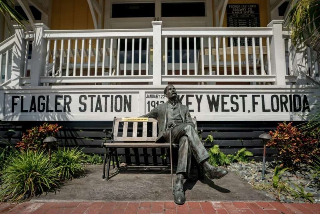
Henry Flagler’s railway expansion created a dependable connection between coastal settlements and the rest of the country. The Florida East Coast Railway reached Fort Lauderdale in March 1896 and Miami in April of that year. Its extension to Key West followed in 1912.
Rail access changed the practical possibilities of development. Agricultural producers could ship crops north. Visitors could travel south more easily. Construction materials and manufactured goods could reach settlements with greater reliability.
The railroad also depended on a substantial workforce. Broward County Library’s railway archive records that Philemon Bryan supervised 400 Black workers constructing the line from Pompano to Miami. Many early permanent Black residents of Broward County arrived through railway employment. Their labor belongs alongside the better known accounts of investors and promoters.
In Miami, Julia Tuttle helped secure Flagler’s extension through land commitments and negotiations. William and Mary Brickell were also important early landowners. The first train entered Miami in April 1896, and the city incorporated on July 28.
Miami’s emergence demonstrates how transportation and land development worked together. Railway construction connected the settlement to outside markets, while land agreements made terminals, hotels, streets and a growing town possible.
The same relationship appeared in smaller communities along the route. Stations became gathering places, commercial centers and points around which towns organized themselves.
Agriculture Builds the Early Coastal Communities
Many places now associated with oceanfront living began with farming.
The southeastern coast offered opportunities to grow crops for northern markets. Railway shipping made that agricultural economy more practical, linking local producers to customers far beyond Florida.
Pompano’s early development illustrates the pattern. Residents grew pineapples, tomatoes, beans, peppers and other crops. Goods and services moved through the railway, and the station served civic purposes as well as transportation needs. Residents gathered there to vote for incorporation in 1908.
Deerfield developed around a similar relationship between agriculture and rail access. A post office was established in 1898, and produce shipment became central to the settlement’s economy. The town incorporated on June 11, 1925, under the name Deerfield. It adopted the name Deerfield Beach in 1939.
The community remained primarily agricultural into the late 1940s. Tourism later became more prominent as visitors discovered the oceanfront and hotels and motels expanded along the shore.
These origins explain an important feature of South Florida’s urban geography. Early commercial districts often grew around inland railway corridors, while beachfront areas developed through a different sequence of investment.
The historic center of a city and its best known coastal destination may therefore reflect two separate stages of its growth.
Palm Beach and the Emergence of the Luxury Resort Landscape
Agriculture supported working communities, while resort development introduced another powerful influence: affluent visitors seeking winter residences and seasonal recreation.
Flagler’s railway system reached what is now West Palm Beach in 1894. His Royal Poinciana Hotel opened in Palm Beach that year. Additional investment included the Palm Beach Inn, later known as The Breakers, and Whitehall, his private winter residence.
Together, railway access and major hospitality projects helped establish Palm Beach as a destination for wealthy Americans during the Gilded Age.
The implications extended beyond individual buildings. A resort destination required transportation, services, landscaping, recreation and accommodation. Private residences developed within that larger setting.
Palm Beach helped establish an enduring connection between South Florida and a particular residential ambition: a home that offered the experience of a retreat while remaining connected to sophisticated social and economic networks.
The architectural expression of that ambition would change. Its underlying appeal of warm weather, access to the water, outdoor living and carefully designed surroundings would remain influential.
Addison Mizner and the Mediterranean Vision
Addison Mizner gave early South Florida luxury development a distinctive architectural direction.
After arriving in Palm Beach in 1918, Mizner designed the Everglades Club for Paris Singer. Its success led to commissions for residences serving prominent resort families. Mizner also established workshops producing decorative materials and furnishings, including tile, ironwork and cast stone.
His work combined architectural design with the atmosphere of a complete environment. Walls, courtyards, passageways, gardens, finishes and interiors contributed to the experience.
In 1925, Mizner pursued an ambitious development venture in Boca Raton. His plans envisioned a resort community with hotels, landscaped streets, recreation, shopping and substantial residences. Financial collapse prevented much of that vision from being realized.
Boca Raton incorporated in May 1925, and Mizner’s Cloister Inn was completed in 1926. Although many proposed projects did not survive the end of the boom, his architectural influence remained.
This history helps explain why Mediterranean Revival remains meaningful in South Florida. Its connection to the region comes from a period when architecture helped define the identity of new resort communities.
It also offers an important historical distinction: the influence of a development vision can outlast the financial success of the venture that introduced it.
The Land Boom and the Limits of Speculation
During the 1920s, Florida’s growing reputation attracted buyers, investors and developers seeking opportunities in land.
Some projects created durable communities. Others were more speculative, relying on continued demand and rising prices.
Coral Gables became one of the period’s important planned developments. George Merrick’s vision transformed family agricultural land into a community associated with Mediterranean Revival architecture, coordinated planning and a strong visual identity. The town incorporated in 1925.
Miami Beach followed its own development path. A bridge connection completed in 1913 improved access from the mainland, and the town incorporated in 1915. Developers and promoters, including the Lummus brothers and Carl Fisher, helped shape its emergence as a resort destination.
Across the region, development required more than selling lots. Streets, utilities, transportation, buildings and services had to turn a proposed community into a functioning place.
The Great Miami Hurricane struck on September 18, 1926, causing extensive destruction across the metropolitan area and beyond. It exposed the vulnerability of a rapidly growing region to a major coastal storm.
The collapse of the boom and the subsequent national Depression interrupted ambitious plans. In Boca Raton, the historical record clearly distinguishes Mizner’s proposed resort landscape from the smaller number of projects actually completed.
The lesson is useful when reading South Florida’s history: a promotional map represents an intention. It does not necessarily document a neighborhood that existed.
Art Deco and the Evolution of Regional Architecture
South Florida’s architecture continued to evolve after the early resort boom.
Miami Beach’s first Art Deco buildings appeared in 1933, according to the city’s architectural history. The style became an important part of the community’s identity, offering a different visual language from the Mediterranean architecture associated with earlier development.
Later preservation efforts helped bring renewed attention to these buildings. The Miami Design Preservation League formed in 1977, and the district’s architecture became an increasingly recognized cultural asset.
The familiar appearance of today’s Art Deco district also contains layers of later interpretation. The National Park Service notes that many buildings were originally predominantly white, with limited colored accents. The broader pastel treatment associated with the district developed through subsequent revival efforts.
The district was listed on the National Register of Historic Places in 1979, although designation alone did not prevent all demolitions.
This is another recurring theme in the region’s development. Architectural identity is shaped through construction, alteration, preservation and public perception.
What people recognize as traditional South Florida architecture often represents several generations of decisions about what to build, what to change and what to retain.
Drainage and Water Management Transform the Region
While architecture changed the appearance of South Florida, water engineering altered the conditions under which development occurred.
Expanded dredging between 1905 and 1910 converted substantial wetland areas to agricultural land. Additional canals, roads and construction displaced habitats as settlements grew. The National Park Service documents these changes as part of the development history of the Everglades.
Major storms and flooding later increased pressure for a coordinated regional system. Following devastating flooding in 1947, federal action produced the Central and Southern Florida Project. Congress authorized it in 1948, and construction began the following year. The state created the Central and Southern Florida Flood Control District in 1949.
The project’s purposes included flood control, water supply, prevention of saltwater intrusion and support for environmental resources. Its reach extended well beyond individual cities.
It is important to distinguish this regional infrastructure from canals created or modified for waterfront residential development. A drainage canal, a navigation channel and a neighborhood waterway can serve different purposes, even when they form part of a connected landscape.
Water management made new patterns of land use possible. It also created ongoing responsibilities. South Florida’s homes and communities depend on infrastructure that must balance rainfall, water supply, environmental needs and coastal conditions.
World War II and the Expansion of Year Round Living
World War II accelerated Florida’s development through military investment and transportation improvements.
The state became a major training location for military personnel. Highway and airport construction expanded, leaving infrastructure that could support civilian travel and economic growth after the war.
The Florida Department of State identifies subsequent migration from elsewhere in the United States and from countries throughout the Western Hemisphere as major influences on postwar population growth.
Florida Memory also documents the return of people who had trained or served in the state. Their familiarity with Florida helped fuel later visitation and settlement.
Air conditioning added another practical influence. As equipment became more affordable and widespread, comfortable year round living became accessible to more households. The U.S. Department of Energy identifies the expansion of residential air conditioning as a contributor to population growth in hot weather states, including Florida.
Together, these changes supported a broader residential economy. South Florida increasingly accommodated permanent households, employment centers, schools and everyday services alongside seasonal visitors.
That transition created the conditions for the substantial suburban and waterfront development that followed.
Pompano Beach From Agricultural Town to Coastal City
Pompano Beach’s history preserves the region’s transition from agricultural settlement to a more diversified city.
The original town incorporated in 1908. In 1947, Pompano merged with a newly formed beachfront municipality and became Pompano Beach. Farming continued to matter well into the 1960s, while tourism, boating and light industry became increasingly significant.
Residential development replaced portions of the agricultural landscape. Beachfront accommodations expanded, and new businesses broadened local employment. Later, redevelopment efforts addressed both the beach corridor and historic inland areas.
For an understanding of the city’s residential character, these stages should be considered together. Pompano Beach includes the legacy of its railway town, its agricultural economy, its coastal tourism and its later neighborhood growth.
Its identity therefore extends beyond the beachfront. The city’s development reflects the interaction of working infrastructure, residential life, recreation and successive efforts to renew established areas.
For a custom home builder, that history encourages attention to the specific setting of a property. Different parts of the city developed under different conditions, and their character cannot be reduced to a single architectural description.
Lighthouse Point and the Waterfront Residential Community
Lighthouse Point represents a different stage of South Florida’s growth.
The city’s municipal history describes an area of farmland and mangrove swamps before residential development gained momentum. Development acreage was acquired in 1951, and the first home in the Hillsboro Isles subdivision was completed that year.
Residents voted to incorporate the Town of Lighthouse Point on June 13, 1956. A state charter followed in June 1957, establishing it as a city.
Subdivisions including Venetian Isles, Lighthouse Manor and Wooler Heights were added between 1957 and 1969. Annexations in 1970 further expanded the community.
These events place Lighthouse Point firmly within the postwar residential era. Its development illustrates how new communities established their own municipal identities while the surrounding metropolitan area expanded.
For waterfront residential design, the relationship between the house and its setting becomes central. Outdoor spaces, water views, privacy and access must be considered as parts of one property.
The historical perspective adds depth to that process. The neighborhood itself is the result of earlier choices about subdivision, infrastructure, municipal services and the use of coastal land.
Deerfield Beach and the Transition to a Coastal Economy
Deerfield Beach shares the agricultural and railway origins of neighboring communities, but followed its own civic and economic development.
Its incorporation in 1925 established a municipal government during the land boom. The later addition of “Beach” to its name reflected an increasingly prominent coastal identity.
The city’s official history describes the shift from agriculture toward tourism after World War II, followed by a more diversified economy that included manufacturing, distribution and offices.
That progression helps explain how a settlement organized around produce shipping became a city serving a broader range of residents and businesses.
The significance for residential development is the continuity beneath the change. New homes enter an existing community with established streets, commercial areas, recreational spaces and layers of older construction.
Building within that setting requires attention to the neighborhood as it exists today, while recognizing that its present form grew through several different economic eras.
Boca Raton Beyond the Resort Vision
Boca Raton’s history extends well beyond its association with Addison Mizner.
Early agriculture included pineapple cultivation and the Yamato Colony, founded by Japanese immigrants under Joseph Sakai in 1904. Later, winter vegetable production remained important.
In 1942, the Army Air Corps established a radar training facility on land now associated with Florida Atlantic University and Boca Raton Airport. Military activity brought personnel, families and civilian employees to the community.
Further transformation followed in the 1960s. Florida Atlantic University became part of the city’s institutional landscape, and IBM established a facility in 1967. The IBM personal computer was developed in Boca Raton in 1981.
The city consequently developed through several overlapping identities: agricultural settlement, resort community, military training location, university city and technology center.
That variety is important. Boca Raton’s residential appeal cannot be explained solely by its early architectural reputation. Its history also includes education, employment, transportation and sustained community investment.
Its architectural heritage remains visible, but the larger story is one of successive additions to the city’s economic and civic life.
Parkland and the Preservation of a Country Setting
Parkland offers an inland counterpart to the region’s coastal communities.
Founded in 1963 by cattle farmer Bruce B. Blount, the city developed from land associated with his family’s holdings and the BBB Ranches development.
Its municipal history emphasizes a country atmosphere and gradual establishment of services. Residents organized volunteer firefighting, developed local institutions and experienced the arrival of paved roads in the 1980s and the first traffic light in the 1990s.
Parkland’s appeal reflects a different residential priority from waterfront access or proximity to a resort district. Landscape, space, privacy and the relationship between the home and its grounds take on particular importance.
Its history also illustrates the role of local government and community preferences in shaping growth. Metropolitan expansion does not produce identical places. Individual municipalities can pursue different approaches to density, services, landscape and neighborhood character.
For estate home design, the setting is therefore more than available acreage. It includes the community’s expectations and the qualities that residents have worked to preserve.
The People Who Shaped the Region
A history focused only on investors, architects and subdivisions would leave out much of South Florida’s development.
Railway crews, farmworkers, builders, hospitality employees, business owners and public servants made expanding communities function. Black residents and Bahamian migrants were among the people who contributed to early settlements and their economies.
Access to the region’s opportunities was unequal. Segregation affected public life, and civil rights activism helped challenge those restrictions. Broward County’s historical resources document Eula Johnson’s role in the 1961 wade-ins protesting segregation at Fort Lauderdale’s beach.
Immigration also reshaped the region. Miami’s Freedom Tower served as the Cuban Assistance Center from 1962 to 1974, helping refugees with needs including housing, education, health care and financial assistance. The building connects an earlier architectural era with a later chapter of migration and community formation.
South Florida’s built environment records these human experiences. A building may begin as one institution and later serve another. A neighborhood may change as new residents establish businesses, homes and cultural ties.
Development is therefore a social history as well as a history of land and construction.
Hurricanes and the Evolution of Building Standards
Hurricanes have repeatedly influenced South Florida’s construction history.
The damage caused by Hurricane Andrew exposed serious problems in the administration, enforcement and compliance of the existing building code system. Florida’s response involved examination of a complicated framework of local regulations and the development of a more consistent statewide approach.
The Florida Building Commission’s account emphasizes that enforcement and compliance were central concerns. The historical lesson extends beyond the existence of written standards to how those standards are applied.
The statewide Florida Building Code took effect on March 1, 2002. The commission’s report to the 2003 Legislature describes the transition and the attention given to wind design and protection against windborne debris.
This chapter has a direct relationship to modern residential construction. Architectural quality and structural performance must be considered together. A home’s appearance is only one part of its design.
The region’s history demonstrates why responsible building requires coordination among owners, architects, engineers, contractors, inspectors and product suppliers. Experience with storms has helped shape a construction culture in which technical decisions carry lasting consequences.
Environmental Restoration and the Responsibilities of Growth
The infrastructure that supported South Florida’s expansion also changed its ecosystems.
Drainage, altered water flows and conversion of land affected the Everglades and surrounding environments. Later generations began addressing those consequences through restoration and revised water management.
Congress authorized the Comprehensive Everglades Restoration Plan in 2000. The federal and state partnership seeks to restore, protect and preserve regional water resources by addressing the quantity, quality, timing and distribution of water.
Restoration belongs within the development story because growth and environmental conditions remain connected. The same region must accommodate communities, maintain water supplies, manage flooding and protect ecosystems.
This relationship encourages a more informed view of residential development. A property is part of a neighborhood, a municipality and a larger physical system.
Decisions about construction should therefore begin with the conditions of the actual site. Drainage, landscape, existing infrastructure and applicable requirements deserve careful examination alongside the owner’s architectural goals.
The Next Chapter in South Florida Residential Development
South Florida’s residential landscape contains the results of many different ambitions.
Railway settlements sought access to markets. Resort developers created destinations. Agricultural communities diversified. Postwar municipalities established new neighborhoods and public services. Preservation efforts protected architectural resources, while building reforms responded to lessons from major storms.
Modern custom homes enter that accumulated history.
A waterfront property in Lighthouse Point presents a different setting from an estate site in Parkland. A home in Boca Raton may draw on a long architectural tradition while meeting contemporary expectations. Projects in Pompano Beach and Deerfield Beach become part of cities shaped by agriculture, transportation, tourism and established residential life.
For Ronin Development, those differences are meaningful. The company’s focus on custom luxury homes in Pompano Beach, Lighthouse Point, Deerfield Beach, Boca Raton and Parkland places its work within several distinct chapters of South Florida’s development.
The opportunity is to create homes that respond thoughtfully to their location and to the people who will live in them. That involves architectural judgment, careful planning, construction discipline and an understanding of the surrounding community.
South Florida’s history shows how much a place can change. It also shows what continues to matter: the relationship between land and water, the infrastructure that supports daily life, the character of individual neighborhoods and the quality of the buildings people leave behind.
Explore Ronin Development’s projects to see the company’s approach to creating distinctive living spaces in South Florida.
A Timeline of Southeastern Florida’s Development
These selected milestones summarize the major transitions discussed in this article. They distinguish settlement, municipal incorporation, infrastructure development and later institutional changes.
| Period | Historical Milestone |
|---|---|
| Before European contact | Indigenous communities establish settlements, trade networks and ways of living shaped by South Florida’s land and waterways. |
| 1821 | The United States takes possession of Florida following ratification of the Adams–Onís Treaty. |
| 1835–1842 | The Second Seminole War brings warfare and forced removal, while some Seminole communities remain in Florida. |
| 1845 | Florida becomes a state. |
| 1855–1858 | The Third Seminole War further disrupts Indigenous communities and settlement. |
| 1894 | Flagler’s railway reaches West Palm Beach, and the Royal Poinciana Hotel opens in Palm Beach. |
| 1896 | The railway reaches Fort Lauderdale and Miami. Miami incorporates on July 28. |
| 1904 | The Yamato Colony is established in the Boca Raton area under Joseph Sakai. |
| 1908 | Pompano incorporates as a town. |
| 1912 | The Florida East Coast Railway extension reaches Key West. |
| 1915 | Miami Beach incorporates, and Broward County is established. |
| 1925 | Boca Raton, Deerfield and Coral Gables incorporate during the Florida land boom. |
| 1926 | Mizner’s Cloister Inn is completed. The Great Miami Hurricane strikes on September 18. |
| 1933 | The City of Miami Beach dates the appearance of its first Art Deco buildings to this year. |
| 1939 | The Town of Deerfield changes its name to Deerfield Beach. |
| 1942 | A major Army Air Corps radar training facility is established in Boca Raton. |
| 1947 | Pompano merges with a beachfront municipality to become Pompano Beach. Severe regional flooding strengthens the case for coordinated water management. |
| 1948–1949 | Congress authorizes the Central and Southern Florida Project. Construction begins, and Florida establishes its flood control district. |
| 1956–1957 | Lighthouse Point incorporates as a town in 1956 and receives its city charter in 1957. |
| 1961 | Civil rights wade-ins challenge segregation at Fort Lauderdale’s beach. |
| 1962–1974 | Miami’s Freedom Tower serves as the Cuban Assistance Center. |
| 1963 | Parkland is founded. |
| 1967 | IBM establishes a facility in Boca Raton. |
| 1979 | The Miami Beach Architectural Historic District is listed on the National Register of Historic Places. |
| 1981 | The IBM personal computer is developed in Boca Raton. |
| 2000 | Congress authorizes the Comprehensive Everglades Restoration Plan. |
| 2002 | The statewide Florida Building Code takes effect on March 1. |
Begin the Conversation About Your South Florida Luxury Home
Whether you are considering Pompano Beach, Lighthouse Point, Deerfield Beach, Boca Raton or Parkland, Ronin Development welcomes the opportunity to learn about your plans. Call to discuss your property, your vision and the steps involved in creating a custom luxury residence.

Sources and research date: Historical information reviewed October 13, 2026. This article provides a chronological overview of southeastern Florida, with particular attention to Miami-Dade, Broward and Palm Beach counties and the communities Ronin Development serves. It is not an exhaustive history of the entire southern Florida peninsula.
Landscape, Indigenous history and territorial development:
- National Park Service: Geology of the Everglades and South Florida
- National Park Service: Native Peoples
- Seminole Tribe of Florida: Historical Introduction
- State Library and Archives of Florida: Territorial Era Research Guide
- State Library and Archives of Florida: Seminole Wars and Military Records
Railroads, early settlements and resort architecture:
- Broward County Library Digital Archives: Florida East Coast Railway Company Records
- Florida Division of Historical Resources: Julia Tuttle Historical Marker
- City of Pompano Beach: Henry Flagler and the Railroad
- Historical Society of Palm Beach County: Getting to Palm Beach
- Boca Raton Historical Society: Addison Mizner
- Florida Memory: Miami’s Master Suburb and the Development of Coral Gables
- City of Miami Beach: How Miami Beach Began
Architecture, community growth and regional change:
- City of Miami Beach: Art Deco Timeline
- National Park Service: Color and Architectural Preservation in South Beach
- National Weather Service: The 1926 Great Miami Hurricane
- Florida Department of State: World War II and the Postwar Boom
- Florida Memory: Florida During World War II
- U.S. Department of Energy: History of Air Conditioning
- Broward County: Black History Resources
- National Park Service: Freedom Tower
Local community histories:
- Pompano Beach Historical Society: Our History
- Advisory Council on Historic Preservation: Pompano Beach
- City of Lighthouse Point: History
- City of Deerfield Beach: History
- Boca Raton Historical Society: A Brief History
- City of Parkland: A Brief History
- Broward County: Preserving Broward’s History
Water management, restoration and building standards:
- National Park Service: Developing the Everglades
- South Florida Water Management District: History
- U.S. Army Corps of Engineers: Central and Southern Florida Project
- South Florida Ecosystem Restoration: Comprehensive Everglades Restoration Plan
- Florida Building Commission: Background of the Statewide Building Code System
- Florida Building Commission: Report to the 2003 Legislature
Editorial note: Historical sources may differ in terminology, geographic scope and their treatment of particular events. This article distinguishes early settlement from municipal incorporation and proposed developments from completed projects. Connections drawn between historical development and contemporary residential design are editorial interpretation. References to historical construction reforms do not establish the current requirements or development potential of any individual property.